
Maxar Technologies is a leader in space technology and Earth intelligence. It was formed in 2017 by merging DigitalGlobe and MDA Holdings Company.
The company is known for its high-quality satellite imagery and geospatial solutions. These tools help make important decisions in defence, business, and the environment.
In 2023, Advent International bought Maxar. This led to a big change. Now, Maxar works in two areas: Vantor for intelligence and Lanteris for space systems.
Maxar’s work helps us see and understand our planet better. Its innovations give us key insights for tackling global issues and finding new chances.
Understanding Maxar Technologies’ Core Business
Maxar Technologies is at the forefront of space technology and Earth observation. It combines top-notch satellite making with advanced geospatial intelligence. This mix helps Maxar serve both commercial and government markets.
The Evolution of Maxar Technologies
In 2017, a big merger started Maxar’s journey. MDA, a leader in space tech, joined forces with DigitalGlobe, the top Earth imagery provider. This move made Maxar a standout in the aerospace field.
The merger merged MDA’s satellite and robotics know-how with DigitalGlobe’s Earth observation skills. This blend made Maxar a full-service space solutions provider. Today, Maxar operates through two main divisions.
Key Divisions and Their Functions
Maxar has two main units. Each division focuses on a key part of the company’s mission. Together, they offer a complete range of space tech and intelligence services.
Related Posts:
- What Is Sensata Technologies Sensors and Controls…

- What Is Infineon Technologies Semiconductor Solutions Leader

- How Technology Affects Marketing Digital Strategies…

- What Is Information Science and Technology Data and…

- How Smart Home Tech is Shaping the Future of Living in 2025

- How Technology Has Helped Society Key Benefits and Examples

Space Infrastructure Division
This division carries on MDA’s tradition of excellence in space tech. Based in Palo Alto, California, it’s all about satellite making and space robotics. The team crafts advanced spacecraft for various missions.
They’re known for the Canadarm robotic system and other cutting-edge tech. Their work helps both private companies and government space projects.
Earth Intelligence Division
Based in Westminster, Colorado, this division deals with geospatial data and imagery. It builds on DigitalGlobe’s Earth observation expertise. The team gathers and analyses high-resolution space images.
They offer vital data for many uses. Their services aid in urban planning, environmental tracking, and national security. The images help organisations make better decisions with accurate geospatial info.
The two divisions work as one to offer complete solutions. The Space Infrastructure Division makes the satellites for the Earth Intelligence Division’s data collection. This teamwork showcases Maxar’s strength in aerospace and intelligence.
Maxar’s Space Technology Capabilities
Maxar Technologies leads in space innovation, blending experience with new tech. They work on advanced satellites and space robots. This pushes the limits of what’s possible in space.
Satellite Manufacturing and Design
Maxar’s satellite team makes top-notch spacecraft for communication and Earth watching. Their innovative designs boost function while keeping things reliable in space.
They use state-of-the-art materials and strict testing. Each satellite is checked carefully before it’s launched. This makes Maxar a reliable partner for space projects.

Robotics and Space Infrastructure
Maxar’s robotics team is key to their space tech. These systems help with building, fixing, and exploring in space.
The Canadarm Legacy
The Canadarm series is a big win in space robotics. Made for the Space Shuttle, these arms are known for their precision.
Maxar’s work includes Canadarm2 and Dextre on the International Space Station. They’ve helped with many missions, like putting up satellites and fixing the station.
Next-Generation Space Robotics
Maxar is now working on new robotic systems for future missions. They’re making arms for NASA’s Lunar Gateway, a base for moon exploration.
Their new robots will help with on-orbit servicing and building. This could change how we keep and update satellites in space, making them last longer.
Maxar is also helping NASA’s Artemis program. They’re making the power and propulsion element for the Lunar Gateway. This part will give energy, communications, and transport for moon missions.
Maxar’s work in satellites and robots is shaping our space future. They’re helping us explore and build in space.
Earth Intelligence Services and Applications
Vantor, formerly Maxar’s Earth Intelligence division, leads in geospatial intelligence with top satellite tech. It turns raw data into useful insights for many sectors globally.
Geospatial Intelligence Gathering
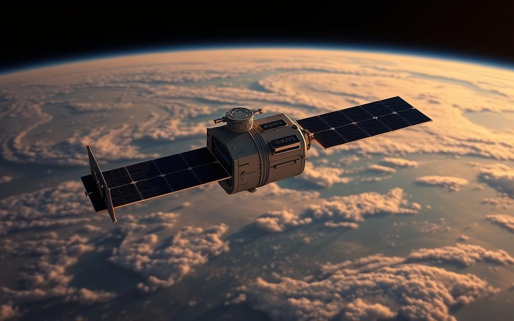
Vantor’s data collection is at the top with satellite imagery tech. They use advanced constellations, like WorldView satellites, for high-resolution images.
They process this data with AI, like Tensorglobe. This system finds patterns, spots changes, and makes detailed datasets.
Vantor’s tech lets us watch global changes in real-time. It creates a digital Earth model that experts call a living digital twin.
Commercial and Government Applications
Vantor’s geospatial intelligence helps both public and private sectors. It’s used for security, planning cities, and protecting the environment.
Defence and Intelligence Uses
Defence applications are key for Vantor. Military and spy agencies use their images for planning and awareness.
This tech is key in wars. It lets us see military moves and help in emergencies.
It’s also used for border checks and threat checks. This helps governments make smart decisions.
Commercial and Environmental Monitoring
Commercial monitoring helps businesses make smart choices. Companies use this data for market studies and planning.
Environmental monitoring is also important. Vantor tracks deforestation, ice changes, and city growth.
This tech helps in disasters like wildfires and floods. It gives vital info during emergencies.
| Application Type | Primary Users | Key Benefits | Example Use Cases |
|---|---|---|---|
| Defence & Intelligence | Military organisations | Strategic awareness, threat detection | Conflict monitoring, border security |
| Commercial Mapping | Navigation companies | Accurate positioning, route planning | App development, urban planning |
| Environmental Protection | Conservation agencies | Ecosystem monitoring, change detection | Deforestation tracking, disaster response |
| Infrastructure Development | Construction firms | Site analysis, progress monitoring | Project planning, resource management |
Vantor is growing its Earth intelligence. They’re using AI and machine learning for better tools.
More and more groups see the value of geospatial data. Vantor’s services help us understand our world better.
Notable Projects and Technological Achievements
Maxar Technologies leads with groundbreaking projects in space technology and Earth observation. These efforts show the company’s dedication to innovation. It plays a key role in both commercial and government sectors.

WorldView Legion Constellation
The WorldView Legion is a major technological achievement for Maxar in Earth observation. It’s a satellite constellation of six high-resolution satellites launched in 2024. They aim to change how we watch our planet.
These satellites can take pictures of the same spot many times a day. This helps with planning cities and tracking the environment. Their accuracy means decision-makers get the best information.
NASA’s Artemis Programme Contributions
Maxar is key to getting humans back to the Moon with NASA Artemis. The company is making parts for the Lunar Gateway. This will be a base for exploring the Moon and Mars.
Maxar is working on the Power and Propulsion Element for the Gateway. It will provide energy and communications. Maxar’s skills in space tech help the Artemis program achieve its goals.
Global Emergency Response Initiatives
Maxar’s tech is vital in emergencies with its emergency response efforts. The company gives satellite images for disaster monitoring and aid worldwide.
In the Ukraine conflict, Maxar’s satellites gave important information. They also help with natural disasters like earthquakes and floods. This quick data helps save lives and coordinate relief efforts.
Maxar’s work shows its role in space innovation and Earth intelligence. The company keeps finding solutions for space exploration and Earth’s challenges.
Conclusion
Maxar Technologies is a top name in space tech and Earth intelligence. It has grown over decades with innovations in satellites, robotics, and geospatial data. The 2023 acquisition by Advent International has brought a new era. Now, it operates under Vantor for intelligence and Lanteris for space systems.
This summary shows Maxar’s big impact on both commercial and government fields. It helps NASA’s Artemis program and aids in global emergencies. The outlook for space tech is good, thanks to Vantor and Lanteris. They keep Maxar’s high standards alive for future space and security needs.
The future looks bright for Maxar. Vantor and Lanteris are ready to grow, using their experience. As Maxar Space Systems uses its past, it leads in solving tomorrow’s problems. Its focus on innovation and reliability keeps Maxar at the forefront of space and Earth observation.
FAQ
What is Maxar Technologies and what are its main areas of focus?
Maxar Technologies is a top name in advanced space tech and Earth intelligence. It was created in 2017 by merging DigitalGlobe and MDA. The company focuses on satellite-based solutions for defence, commercial, and environmental needs.
How is Maxar Technologies structured, and what are its key divisions?
Maxar has two main parts: Space Infrastructure and Earth Intelligence. Space Infrastructure makes satellites and space robots, like the Canadarm. Earth Intelligence collects and analyses geospatial data for various uses.
What are Maxar’s capabilities in satellite manufacturing and space robotics?
Maxar is skilled in making top-notch satellites and space robots. They’ve built communication and Earth observation satellites. They also have a legacy in space robotics, including the Canadarm, and are working on new robots for space missions.
How does Maxar gather and use geospatial intelligence?
Maxar uses advanced satellites to gather data. They then use AI to process it for quick insights. This data helps in defence, intelligence, and commercial fields like urban planning and navigation apps.
What are some of Maxar’s notable projects and achievements?
Maxar has worked on big projects like the WorldView Legion constellation. It also helps NASA’s Artemis programme for the moon. They use satellite data for emergency responses worldwide.
How has Maxar evolved recently in terms of ownership and branding?
Maxar has changed under private ownership. It rebranded its divisions: Earth Intelligence is now Vantor, and Space Infrastructure is Lanteris. These changes aim to improve services and focus on new spatial intelligence solutions.
What role does Maxar play in global security and commercial markets?
Maxar is key in defence and intelligence with its data and tech. It also helps in commercial fields with accurate geospatial insights. This makes it important in both government and business sectors worldwide.
