
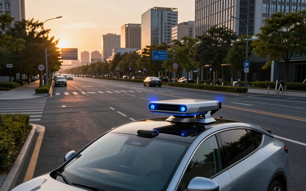
Learning what is lidar technology in cars helps explain how vehicles see and navigate their surroundings. This sensing method uses laser light to measure distances between a vehicle and nearby objects. LiDAR means Light Detection and Ranging, describing its role in building a detailed view of the environment.
Automotive LiDAR improves vehicle safety by helping cars identify road users, obstacles, lane boundaries, curbs, and other vital features. This depth information supports advanced driver-assistance systems and autonomous driving. LiDAR does not make a vehicle autonomous alone; it adds perception data to cameras and radar.
This article explains how LiDAR works, the hardware it uses, and its real-world applications. It also explains how automakers are adopting this technology, plus its limitations and potential future developments. Together, these topics provide a broad view of how LiDAR and car safety sensors support safer, more efficient driving.
Key Takeaways
- LiDAR enhances vehicle safety by accurately measuring distances to nearby objects.
- This technology is essential for advanced driver-assistance systems.
- LiDAR provides depth information that complements other sensors like cameras and radar.
- Understanding LiDAR’s principles is key to grasping its role in autonomous driving.
- Future developments in LiDAR technology promise to improve vehicle navigation further.
What Is LiDAR Technology in Cars?
LiDAR leads automotive innovation and helps cars navigate. The LiDAR definition is Light Detection and Ranging. This system helps vehicles perceive their surroundings in detail.
This explains how automotive LiDAR works: it sends rapid laser pulses and measures returning reflections to estimate nearby object distances.
LiDAR began in scientific measurement and aerial mapping before becoming a key part of modern vehicle perception technology. Its early uses included surveying, robotics, and industrial automation. As automakers pursue safer navigation, LiDAR’s move into vehicles marks major progress.
Defining LiDAR and Its Origin
LiDAR uses laser beams to create a three-dimensional map of its environment. The system emits thousands of laser pulses each second, which bounce off objects and return to the sensor. This process measures distance precisely and builds a broad view of the vehicle’s surroundings.
LiDAR first served geography and meteorology. Its high-resolution data made it valuable for mapping terrain and understanding atmospheric conditions. As automotive technology advanced, engineers saw LiDAR’s value for safer vehicles and navigation systems.
Why LiDAR Matters for Modern Vehicles
In today’s vehicles, LiDAR supports advanced driver-assistance systems (ADAS). As cars move beyond basic cruise control, they need a strong understanding of their three-dimensional environment. LiDAR identifies the position, shape, and approximate dimensions of nearby objects, supporting safe navigation.
Related Posts:
- What Is Ford Co-Pilot360 Technology Driver-Assist…
- What Is Sensata Technologies Sensors and Controls…

- What Is Information Science and Technology Data and…

- How Smart Home Tech is Shaping the Future of Living in 2025

- What Is Infineon Technologies Semiconductor Solutions Leader

- Gel Battery Technology Explained: How It Works,…
LiDAR helps develop autonomous vehicle sensors. By combining LiDAR with cameras and radar, vehicles gain a complete perception platform. This technology fusion improves the function and safety of modern vehicles.
| Feature | LiDAR | Cameras | Radar |
|---|---|---|---|
| Distance Measurement | High precision | Moderate precision | Low precision |
| 3D Mapping | Yes | No | No |
| Performance in Low Light | Excellent | Poor | Good |
| Cost | Higher | Lower | Moderate |
The Science Behind LiDAR: How It Works
LiDAR uses light detection and ranging to help vehicles see their surroundings in real time. It sends laser pulses to collect detailed environmental data. Key ideas include LiDAR time of flight and 3D maps of nearby areas.
The Principle of Light Detection and Ranging
LiDAR systems send laser beams toward nearby objects. A pulse travels until it strikes an object, such as a vehicle or building.
It then reflects back to the LiDAR sensor. This basic process helps the system collect data about its surroundings.
Time-of-Flight and Distance Measurement
Time of flight helps LiDAR calculate distance. The system measures how long a laser pulse travels to an object and back.
Because light speed is known, it can calculate the distance with great precision. This laser distance measurement happens over extremely short time spans, producing accurate readings.
Creating a 3D Map of the Surroundings
Multiple distance readings create spatial data called a 3D point cloud. The cloud shows the environment in three dimensions, including road lanes, vehicles, pedestrians, and other objects. Its quality depends on scan density, range, update speed, and object reflectivity.
Advanced software processes the point cloud data into a complete 3D representation. This representation helps vehicles estimate the position and movement of nearby objects, improving navigation and safety features. LiDAR’s precision supports automotive mapping technology and helps create safer, more efficient driving experiences.
| Measurement Aspect | LiDAR | Traditional Methods |
|---|---|---|
| Distance Measurement | Time-of-flight | Triangulation |
| Data Density | High | Medium |
| 3D Mapping Capability | Yes | No |
| Speed of Data Collection | Fast | Slower |
Key Components of an Automotive LiDAR System
An automotive LiDAR system uses several automotive LiDAR components that work together to improve vehicle perception. Understanding these elements shows how they support the system’s overall function. The sections below explain this sophisticated technology.
Laser Emitters and Detectors
At the heart of every LiDAR system are the LiDAR laser sensors. These sensors produce rapid laser light pulses and direct them toward the environment. When the pulses hit an object, they reflect back to the sensor.
Photodetectors capture this reflected energy, allowing the system to measure distances accurately. This process helps create a detailed view of the vehicle’s surroundings.
Scanning Mechanisms and Optics
The LiDAR optical system directs and focuses the emitted laser light. Mechanical, hybrid, and solid-state designs shape how the sensor captures data.
Mechanical systems can rotate to cover a wide field of view, while solid-state designs offer compactness and reliability. The optics choice affects the LiDAR system’s resolution, range, and overall performance.
Processing Units and Software
The processing unit converts raw sensor data into usable measurements. It runs sophisticated algorithms, while the LiDAR perception software filters noise, groups data points, and identifies objects.
The processed information reaches the vehicle’s control systems for real-time decisions. Sensor placement, field of view, and calibration help ensure optimal performance.
| Component | Function | Importance |
|---|---|---|
| Laser Emitters | Generate laser pulses | Critical for distance measurement |
| Detectors | Capture reflected light | Essential for object detection |
| Optics | Focus and direct light | Affects range and resolution |
| Processing Unit | Convert data to measurements | Enables real-time analysis |
| Perception Software | Filter and interpret data | Supports decision-making |
How LiDAR Helps Vehicles See the Road
LiDAR object detection helps vehicles improve safety and awareness on the road. It gives vehicles an updated view of nearby surroundings. This view helps them navigate complex areas and avoid hazards.
LiDAR uses object detection and classification to identify pedestrians, cyclists, and vehicles. It studies each object’s shape, position, and movement through point-cloud patterns. These systems distinguish a stationary vehicle from a pedestrian crossing the street, supporting timely responses to danger.
Object Detection and Classification
LiDAR can classify obstacles by their characteristics, not only detect them. It can distinguish a motorcycle from a truck, supporting informed driving decisions. Vehicles can then adjust speed and trajectory for the obstacle.
Real-Time Environment Mapping
LiDAR provides real-time road mapping as it detects objects. This map supports localization by showing road boundaries, intersections, and open driving spaces. Near a construction zone, LiDAR can alert drivers to changing conditions, improving awareness and safer navigation.
LiDAR systems continuously update maps to handle changing environments. Real-time mapping helps detect a pedestrian at night or a stopped vehicle beyond a curve.
Supporting Driver-Assistance Features
Driver assistance LiDAR supports driver-assistance features, including forward collision warnings, automatic emergency braking, and lane-change support. With validated software, LiDAR data helps vehicles act early to prevent accidents. If it detects a work-zone barrier, the vehicle can alert the driver or begin braking when necessary.
LiDAR improves vehicle obstacle detection, but it needs other sensors for best performance. Sensor fusion creates a fuller environmental view, helping vehicles respond properly in different situations.
| Feature | Description | Benefit |
|---|---|---|
| Object Detection | Identifies and classifies obstacles | Enhances safety by preventing collisions |
| Real-Time Mapping | Continuously updates road conditions | Improves navigation and situational awareness |
| Driver Assistance | Supports features like emergency braking | Reduces the risk of accidents |
LiDAR vs. Cameras and Radar: A Comparative Look
Comparing LiDAR vs cameras and radar reveals each technology’s strengths and limits. All three automotive perception sensors improve vehicle awareness, but each works best in different situations.
Strengths of LiDAR Over Other Sensors
LiDAR works well in specific situations, especially low light and depth measurement.
Performance in Low-Light Conditions
LiDAR works well in low-light settings because it sends out its own laser signals. Unlike cameras, it can detect objects and measure distances in complete darkness.
Accurate Depth Perception
LiDAR measures distances to objects directly, giving it highly accurate depth perception. This precision helps autonomous vehicles understand their position around nearby objects.
Where Cameras and Radar Still Lead
LiDAR has clear strengths, but cameras and radar also offer important benefits. A LiDAR vs radar comparison shows why vehicles need more than one sensor.
Color Recognition and Traffic Sign Detection
Cameras recognize colors, text, traffic signs, and lane markings well. This information helps vehicles understand roads and follow traffic rules.
Performance in Adverse Weather
Radar remains effective in heavy rain, snow, and fog. LiDAR signals can scatter in airborne particles, while radar still measures distance and speed reliably.
The Case for Sensor Fusion
Sensor fusion in cars combines data from LiDAR, cameras, and radar. This approach helps vehicles build a complete view of their surroundings.
Fusion algorithms match sensor inputs, manage uncertainty, and resolve differences. This process improves the environmental model and supports better vehicle decisions.
| Sensor Type | Strengths | Limitations |
|---|---|---|
| LiDAR | Low-light performance, accurate depth perception | Cost, sensitivity to weather conditions |
| Cameras | Color recognition, traffic sign detection | Performance in low-light, reliance on ambient light |
| Radar | Adverse weather performance, range measurement | Lower resolution, limited object classification |
Current LiDAR Applications in Modern Vehicles
Today, LiDAR applications improve driver safety and vehicle functions. They support advanced driver-assistance systems (ADAS) across many driving situations. These LiDAR ADAS applications support key features in modern vehicles.
Adaptive Cruise Control and Emergency Braking
LiDAR adaptive cruise control uses accurate distance and position estimates for nearby vehicles. This information helps the system keep the chosen following gap. Radar and cameras add speed and classification data, while LiDAR reacts quickly to traffic changes.
LiDAR emergency braking identifies possible collision paths. It estimates whether a pedestrian, vehicle, cyclist, or obstacle lies within the stopping zone. This feature helps prevent accidents and protect passengers.
Lane Detection and Blind-Spot Monitoring
LiDAR creates detailed environmental data for lane detection. This information supports lane-change decisions and blind-spot monitoring. It helps when vehicles or road edges are difficult to interpret visually.
Parking Assistance and Low-Speed Maneuvering
LiDAR parking assistance detects curbs and precisely locates obstacles. It enables automated parking and helps drivers manage tight spaces. Near a parking spot, LiDAR provides real-time data for safer maneuvering.
| LiDAR Application | Functionality | Benefits |
|---|---|---|
| Adaptive Cruise Control | Maintains safe following distance | Enhances driving comfort and safety |
| Emergency Braking | Identifies collision threats | Prevents accidents and injuries |
| Lane Detection | Monitors lane position | Improves navigation and safety |
| Parking Assistance | Guides parking maneuvers | Facilitates easier parking |
System availability varies by vehicle, market, software version, and operating conditions. Drivers must supervise assisted-driving features and remain responsible for safe driving.
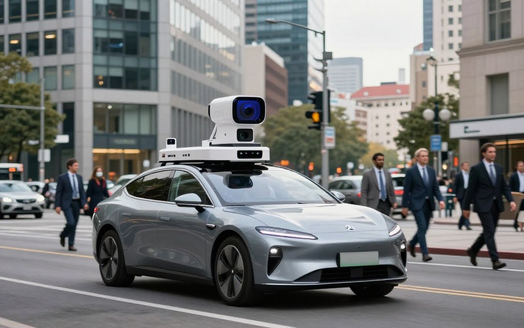
Leading Automakers Using LiDAR Technology
As the automotive industry changes, leading automakers using LiDAR are reshaping driving. LiDAR supports advanced safety systems and automated driving features. These partnerships show how top automakers are testing this technology.
Volvo and Luminar Partnership
Volvo has formed a strategic partnership with Luminar, a leader in LiDAR. The partnership adds long-range sensing to Volvo vehicles, improving safety and automated driving. Volvo Luminar LiDAR provides accurate environmental data for better real-time decisions.
Mercedes-Benz Drive Pilot System
The Mercedes-Benz DRIVE PILOT system combines LiDAR, vehicle sensors, software, and operating limits. It creates a safer setting for regulated automated driving. DRIVE PILOT works only under approved conditions and market rules.
Toyota, Honda, and Other Industry Players
Other automakers, including Toyota and Honda, are exploring LiDAR technology. They support research programs and work with LiDAR suppliers. Their efforts include prototype vehicles with LiDAR for better navigation and safety.
These efforts show varied adoption across the LiDAR automotive industry. Some manufacturers reserve LiDAR for premium models, while others rely mainly on cameras and radar.
| Automaker | Partnership/Technology | Focus Area |
|---|---|---|
| Volvo | Luminar | Safety and Automated Driving |
| Mercedes-Benz | DRIVE PILOT | Regulated Automated Driving |
| Toyota | Various Collaborations | Research and Prototypes |
| Honda | LiDAR Suppliers | Navigation and Safety |
For more insight into leading companies in the LiDAR automotive industry, read this comprehensive overview.
Advantages and Limitations of LiDAR in Cars
LiDAR technology brings benefits and challenges to modern vehicles. Understanding both helps evaluate its effectiveness in automotive applications.
Key Benefits for Safety and Navigation
One major LiDAR benefits in cars is precise depth measurement. It improves spatial awareness, helping vehicles detect and classify nearby objects accurately. High-resolution data clarifies road geometry, supports safer path planning, and strengthens driver assistance systems.
LiDAR also performs well in complex environments where traditional sensors may struggle. It separates objects and creates detailed maps, improving navigation and safety. This matters for autonomous driving, which needs real-time data for decisions.
Current Challenges and Drawbacks
Among LiDAR limitations, the automotive LiDAR cost can be high because production is complex. Mechanical parts and optical assemblies add design and durability challenges, making large-scale production difficult.
Cost and Manufacturing Complexity
The complexity of making LiDAR systems raises their overall cost. This includes initial production expenses, ongoing maintenance, and calibration needs. As technology advances, manufacturers hope to cut costs and simplify system integration.
Weather Sensitivity
Another major limitation is LiDAR weather performance. Fog, heavy rain, snow, and road spray can scatter or block laser signals. These conditions reduce range and system confidence, while redundancy and sensor fusion help but cannot remove the risks.
LiDAR offers major benefits for vehicle safety and navigation, but it also has important challenges. Balanced evaluation of these factors supports informed decisions in the automotive industry.
The Future of LiDAR in Autonomous and Assisted Driving
Automotive technology is changing quickly, and LiDAR helps shape driving’s future. As vehicles become more autonomous, LiDAR advances will improve road safety and efficiency. This section explores the future of automotive LiDAR, solid-state designs, lower costs, and U.S. regulations.
Advances in Solid-State LiDAR
One promising LiDAR advance is the move toward solid-state LiDAR systems. Unlike traditional units, these designs have no moving parts, which improves durability and reliability. Their smaller size allows flexible placement on vehicles.
This flexibility helps manufacturers add LiDAR to different models without harming vehicle design. Better laser efficiency and detector sensitivity also improve performance. Solid-state LiDAR can deliver more accurate data while using less power.
As these systems mature, they will support new autonomous driving technology for many environments.
Cost Reduction and Mass Adoption
LiDAR must become much cheaper before it can move into mainstream automotive use. Today, these systems mainly appear in premium vehicles and specialized fleets. Better manufacturing and larger production volumes should lower costs.
This change will support the mass adoption of LiDAR in higher-volume passenger cars. Better manufacturing yield and system integration will also improve access. The industry must create affordable solutions without reducing safety or performance.
Regulatory and Industry Outlook in the United States
U.S. rules will strongly influence LiDAR’s future. As LiDAR mass adoption grows, standard testing and functional safety will become more important. Regulations must cover cybersecurity, privacy, and liability to build public trust in autonomous vehicles.
Driver-assistance systems need human supervision, while fully automated systems may work under approved conditions. LiDAR adoption will depend on clear safety benefits and reliable real-world performance. This includes performance during adverse weather conditions.
“The path to widespread adoption of LiDAR technology lies in its ability to demonstrate safety and reliability.”
In conclusion, LiDAR’s future depends on better technology, lower costs, and supportive regulations. Together, these factors can transform driving and create safer, more efficient travel.
| Aspect | Current State | Future Outlook |
|---|---|---|
| Technology Type | Mechanical LiDAR | Solid-State LiDAR |
| Cost | High | Decreasing |
| Durability | Moderate | High |
| Regulatory Framework | Developing | Standardized |
Conclusion
What is lidar technology in cars explained: LiDAR uses lasers to measure distance and map nearby areas in three dimensions. This accuracy improves LiDAR car safety and supports modern automotive sensor technology.
The future of LiDAR vehicles depends on combining LiDAR with cameras and radar. LiDAR senses depth and space, cameras show visual details, and radar measures range and speed. This sensor fusion helps overcome each system’s limits.
However, LiDAR still faces major challenges. High costs, complex manufacturing, and weather sensitivity can slow adoption. Regulatory barriers and reliable software are also needed for widespread use.
LiDAR can greatly improve how vehicles understand their surroundings. Yet safe automation needs complete systems, including sensors, strong computers, advanced software, and effective vehicle controls.
Thorough testing and responsible human oversight remain vital as fully automated driving develops. The journey is complex, but LiDAR leads this exciting evolution.